
TL;DR
Heavy rain from a low-pressure system moved across the island of Hispaniola in the last week of October 2026. The Associated Press reported on 27 October at least four people dead and two missing in southwestern Haiti, more than 3,200 families affected there, and at least 30 communities cut off in the Dominican Republic. AI forecasts could support earlier warnings, but their local accuracy and the route from an agency to a household both need testing. Haiti's limited internet reach makes radio and voice part of that task. This week a mayor's office, a community radio station or a church can build and test a one-page alert list.
What happened
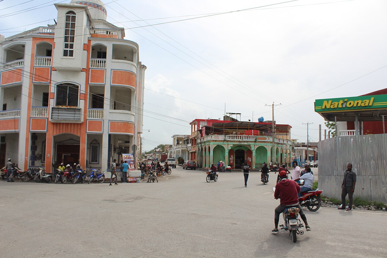
On Tuesday 27 October, the Associated Press reported that rain from a low-pressure system moving through the northern Caribbean had caused flooding and landslides on both sides of the border. In Haiti's southwestern region, at least four people were reported dead and two missing. Haiti's Civil Protection Agency said more than 3,200 families were affected. Hundreds of homes were destroyed, and landslides blocked several roads.
In the Dominican Republic, the Emergency Operations Center reported more than 100 flooded homes and at least 30 communities cut off by water. The agency did not give a death toll for the Dominican side in the report we read.
The numbers
Start with what warning is worth. The Early Warnings for All initiative, run by the United Nations and the World Meteorological Organization, states that according to the Global Commission on Adaptation, 24 hours' notice of a hazardous event can reduce damage by 30 per cent. The initiative's deadline for full coverage is the end of 2027. The 30% figure is a global estimate. It does not come from a Haitian measurement.
Next, what AI forecasting can do for rivers. A Google Research summary of a 2024 paper in Nature reports that the model was trained on 5,680 streamflow gauges and evaluated across 2,092 watersheds in Google's operational comparison. For floods expected once in five years, its precision and recall were similar to or better than the European GloFAS system's accuracy for floods expected once a year. At publication in March 2024, Google reported river forecasts up to seven days ahead in more than 80 countries. That report identified flash floods and urban floods as areas needing further work; the later project below addresses urban flash floods. Neither report establishes local forecast skill for the communities discussed here.
Google tried to close that gap in March 2026. Its Groundsource project used Gemini to read news reports in 80 languages and extract 2.6 million historical flood events across more than 150 countries. Google says a model trained using that record can forecast urban flash floods up to 24 hours ahead. In Google's manual review, 60% of extracted events were right on both location and timing, and 82% were accurate enough to be useful. These percentages describe the extracted historical records, not the accuracy of future forecasts. The team says it is working to cover more rural areas.
Then the reach of the phone. DataReportal's Digital 2026 report for Haiti counts 4.69 million internet users in October 2025, or 39.3% of the population, and 10.1 million cellular connections, equal to 84.6% of the population. About 7.25 million people, 60.7%, were offline. Connections are not people, because one person can hold several SIM cards, so the connection count cannot tell us how many individuals can receive a text.
Last, what an assessment costs in days. After Hurricane Matthew in 2016, a World Bank blog records 546 victims, 128 missing, 439 injured and 2.1 million people affected. Drone teams covered seven villages and two cities in four days, and the full assessment took 15 days. Satellite imagery had been tried first and was limited by poor bandwidth, cloud cover and low resolution.
What this means in Haiti and the Dominican Republic
We apply the method Adrian Dunkley calls People First, Problem Second, AI Last. A test we suggest is to write the human need and the problem in two sentences each with no mention of AI. An illustrative need: a family in a hillside community near Les Cayes has to leave a house before the water arrives, with the children, the documents and the animals that feed them. The problem: the river or the ravine rises faster than the news travels, and the person who sees the first rise has no way to tell the people downstream in time.
Neither sentence needs the word AI. They describe a late signal and a broken last mile. The warning system then has two jobs: detect danger earlier and deliver an actionable message through channels residents use.
Haiti and the Dominican Republic share the island of Hispaniola. The Associated Press report describes impacts in both countries: the Dominican Republic's Emergency Operations Center counted flooded homes and cut-off communities, while Haiti's Civil Protection Agency counted affected families. Those impact counts do not tell us how warnings reached individual communities. The sources inspected here do not establish how many hours of actionable notice particular villages received. That is a limitation of this article's evidence, not proof that the agencies lack warning systems.
Our inference, labelled as such: the cross-border river basins on Hispaniola are a useful place to test shared forecasts, because the water does not stop at the line on the map. The sources inspected here do not evaluate that proposal, so it remains a hypothesis for the two agencies to test.
Where AI could support flood preparation and recovery
Read the river before it rises
Flood Hub's river forecasts exist because AI can learn the behaviour of rivers with few gauges. We found no public account of how many working gauges Haiti has. The Nature paper's design, one model trained on thousands of gauges around the world and applied to places with sparse measurement, is aimed at that problem. We could not confirm from the sources we read whether the forecasts cover the rivers of the Sud department, and Google's own page does not report accuracy for Haiti. The first task for Haiti's meteorological and civil protection staff is to check Flood Hub's coverage map for their rivers and compare its past forecasts with what happened.
Learn from the news about the last flood
Groundsource turns old news reports into flood records. Haitian and Dominican newspapers, radio transcripts and agency bulletins hold decades of such reports in French, Kreyòl and Spanish, and a language model can read them. A municipality could do a small version of the same exercise: list every flood it can remember with a date and a street, and ask a model to tidy the notes into a table that a person then checks. The output is a local flood history. Google reports that this method is weaker where news coverage is thin, and we expect that includes parts of rural Haiti, though we have no measurement.
Assess damage after the flood
The World Bank's Matthew blog describes drones and a comparison with earlier aerial images to assess damaged schools in a 15-day exercise. The blog does not say AI did the comparing. AI-assisted image comparison could help prioritise inspection, but staff would need to check its findings. The account does not establish how quickly such an AI system would work after another flood. Drone flights need permission, batteries and pilots, and the World Bank's April 2021 account said the Haitian government was then setting up its first official drone lab. The point is to rehearse the flight before the emergency.
Write the warning in the language people speak
A public warning needs a place, a time and an action that residents understand. A language model can draft that sentence in Kreyòl, French or Spanish from a forecast, and it can shape the same message for a radio announcer, a WhatsApp voice note and a short text message. The draft must go to a human who speaks the language and knows the place before anyone sends it. Models can make errors in Kreyòl, and a wrong place name in a flood warning sends people to the wrong hill.
Read the diagram as text
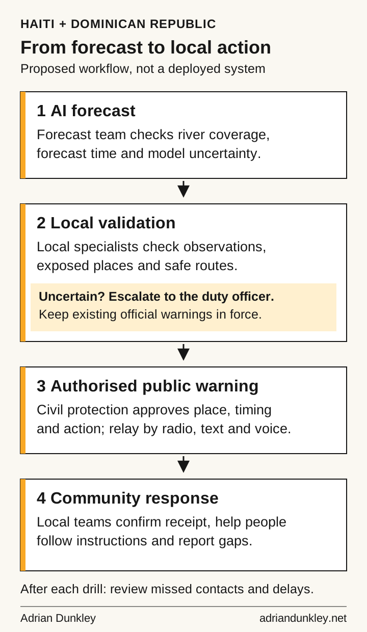
A forecast team checks river coverage, forecast time and uncertainty. Local specialists compare observations, exposed places and safe routes. If evidence is uncertain, they escalate to the duty officer and keep existing official warnings in force. Civil protection approves the place, timing and action for a public warning, relayed through radio, text and voice. Local teams confirm receipt, help people follow instructions and report gaps. After a drill, review missed contacts and delays.
What to do this week
The following dates and counts are suggested exercise parameters, not an official warning protocol. Agree the drill with civil protection and the local radio station before sending anything. Follow official instructions during an emergency.
- List the people downstream. By Sunday 8 November, a mayor's office or community group can invite 30 nearby households to an alert drill. Ask for consent, a preferred contact channel and language, and any assistance needed. Store the contact list securely; do not publish it or upload personal details to an AI service.
- Write one exercise message and have it checked. Start every version with “EXERCISE ONLY”. Include the place, hazard and agreed practice action in Kreyòl, French or Spanish. A local speaker and the responsible official should check the wording, place names and instructions before use.
- Check the river forecast. Open Google's Flood Hub and look for the river and forecast issue time. Ask the local authority for historical forecasts and safely collected observations to compare. Record gaps in coverage. Do not approach floodwater to collect readings or delay an official warning while checking a model.
- Test delivery on Sunday 15 November through the agreed text, voice and radio channels. Count consenting households confirming receipt within 30 minutes. If 21 of 30 respond, that is 70%; this illustrative result is a baseline, not an adequate safety threshold. Follow up every missed household, change a delivery method, then repeat on 29 November and compare the count and delay.
Where this can go wrong
A false alarm can disrupt work or trigger an unnecessary journey. Repeated incorrect alerts may weaken trust, while a missed flood can leave residents without time to act. Google's Groundsource account identifies sparse reporting and rural coverage as limitations. That makes local evaluation necessary before relying on a model in poorly documented communities. Adrian's Agent Colonialism test asks who designs the system, whose data it uses and whose interests its decisions serve. Community participation and a clear account of data rights belong in procurement. The guardrails are plain. Keep Haiti's Civil Protection Agency and the Dominican Emergency Operations Center as the voice that issues warnings, and use AI to feed them. Ask any vendor for its accuracy on a Caribbean sample before adopting it, and treat missing figures as unknown accuracy. Log every false alarm and every miss, and publish the log.
The weakest part of this argument
We found no published evidence that Flood Hub or Groundsource works on Haitian rivers and hillsides. The 30% damage figure is a global estimate repeated by the United Nations, and we read the initiative's page and not the original Global Commission report. AI cannot restore the roads that landslides blocked in October. A better forecast helps only when someone can act on it. The evidence here supports a cheap, local test, and nothing larger.
Questions after the first drill
What should a warning say when a model and local reports disagree?
This proposed workflow gives the disagreement to the duty officer, with the forecast issue time, the observation and its location. Record who reviewed it and when. Continue established official warning procedures while the evidence is checked; an uncertain AI output should never cancel an existing official instruction.
How can a drill distinguish a delivery failure from an unclear message?
Record three separate results: whether the message arrived, whether the household understood the practice action, and whether assistance was needed. Ask consenting participants to repeat the action in their own words. A delivered text alone does not show that its recipient can act on it.
What belongs in the public report after a community warning drill?
Publish aggregate counts and delivery delays, the changes to be tested next, and the office responsible for follow-up. Keep names, phone numbers, exact household locations and individual support needs in a restricted working record. Agree access and a deletion date with the participating households.
What should happen if there is no forecast for the nearest river?
Mark the river as uncovered in the exercise record and ask the responsible authority which existing observation and warning arrangements apply. Do not substitute a general chatbot's prediction. The next test can still measure whether an authorised practice message reaches residents through the agreed channels.
Supported by StarApple AI. Read more at StarApple AI, AI Boss and the Caribbean AI Risk Management Council. Related reading: Caribbean flash flood risk and AI early warning and AI and slow hurricanes in the Caribbean.